
Hypergiant Industries

Explore
CommandCenter

A Common Battle Management Interface
Answering the call for a Common Battle Management Interface (CBI) with CommandCenter
America must innovate to bolster our national security against near-peer adversaries who will soon be utilizing AI-powered hyper-connected systems themselves. The answer is a Common Battle Management Interface (CBI), where data informs real-time decision-making ability and is shared instantly between multiple sources and across all domains.
CommandCenter is a geospatial data visualization platform designed to address the Department of Defense’s most complex operational challenges. The platform’s streamlined interface delivers comprehensive data from a strategic global perspective down to tactical asset-level detail, enhancing situational awareness and enabling warfighters and decision-makers to rapidly execute decisively for threat neutralization and mission optimization.
Features include:
- High-quality speed and design. CommandCenter offers a dynamic and immersive experience with gaming-like speeds and a UI/UX framework that is meticulously designed to provide clear, concise, and easily-interpretable information. The platform supports a myriad of real-time moving entities and data formats in an ultra-high-performant (60-120 fps) front-end.
- Fast implementation. CommandCenter is a plug-and-play platform that is easily customizable to ensure operators receive optimized data, the right way, to maximize efficiency and reduce delays.
- Government rights. Hypergiant’s platform utilizes a tech-agnostic, non-proprietary approach that grants the U.S. government purpose rights. Features of CommandCenter can be merged into the government code base, or they can be copied to a new infrastructure instance and scaled for allied nations or other critical infrastructure and industry applications.
- Security and compliance. Data access and data compliance for all services is pre-determined and then carefully programmed into code to ensure proper guardrails are in place to prevent any sensitive data from leaking.
- No licensing fees. Our business is about delivering new features, which can be used by the government in perpetuity without exorbitant licensing fees or costs that increase with adoption.
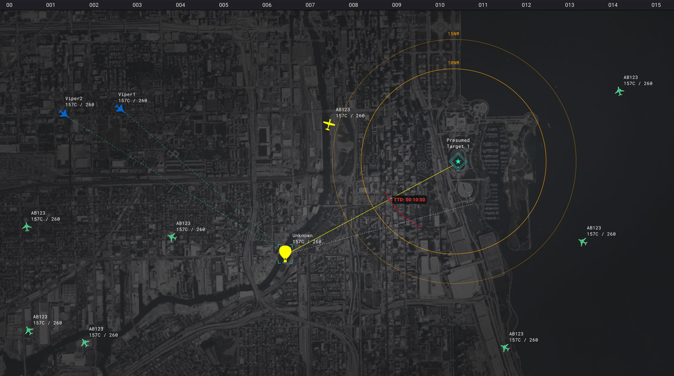
Air Force
Joint All-Domain Command & Control

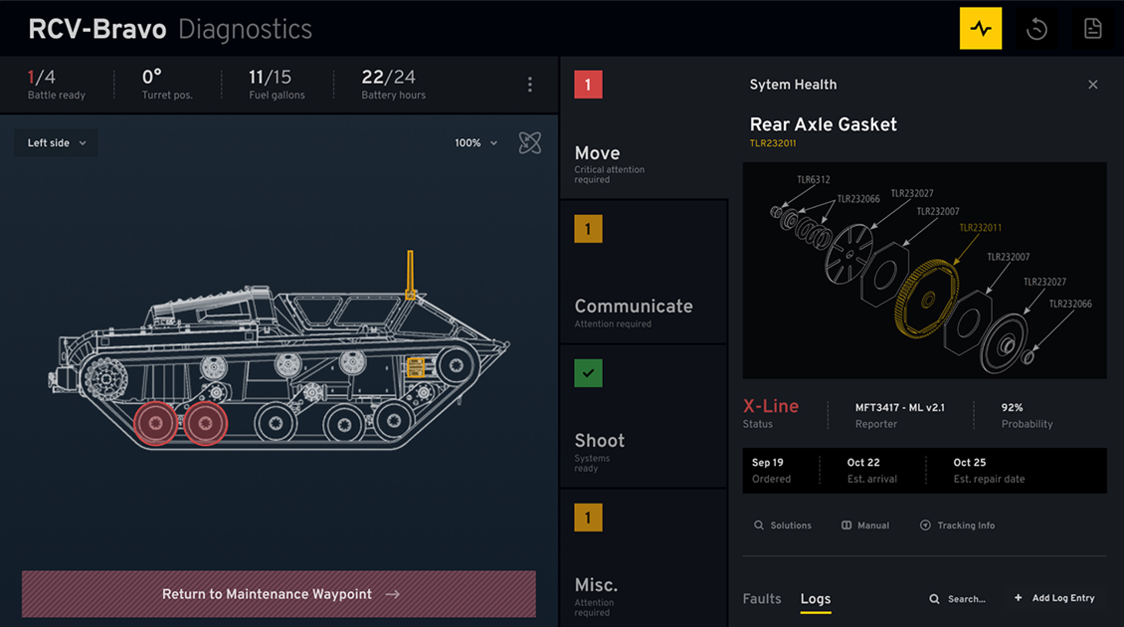
Army
Predictive Maintenance & Sustainment

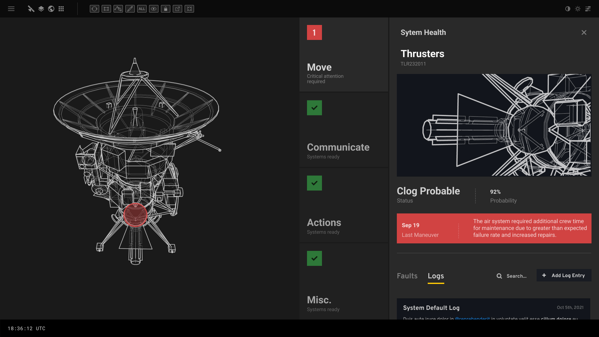
Space Force
In-Space Servicing, Assembly & Maintenance (ISAM)

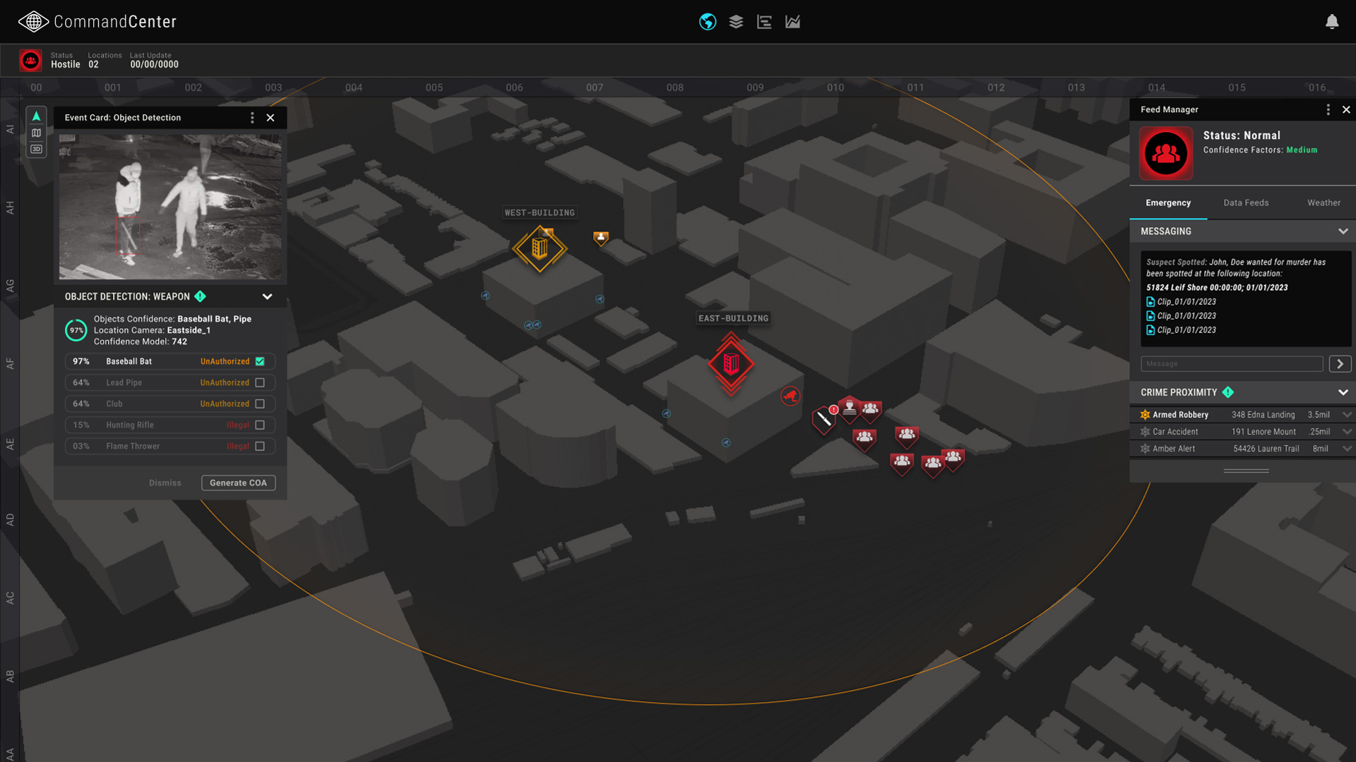
Physical Security
Physical Security
Proud to Support
Proud to Support
We work with leading Fortune 500 companies and government agencies to deliver AI solutions at scale across various industry sectors.


CONTACT
Request a Demo
We are excited to hear from you and look forward to better understanding how we can work together to drive powerful outcomes for your mission-critical initiatives.